Lower Don Lands Toronto
Project Description
Major world cities such as Toronto are in transition, needing to reintegrate strategically important post-industrial landscapes while reframing their interactions with the natural environment. The Lower Don Lands proposal is unique among these efforts by virtue of its size, scope, and complexity.
The proposed redevelopment and revitalization of the Lower Don Lands will transform Toronto’s waterfront into an internationally recognizable destination that combines sustainable city building practices with major river restoration and naturalization undertakings.
In this proposal, the engine of transformative urbanism is a radical reposition of natural systems and attendant landscapes, transportation networks, and urban environments. The imperative of sustainable flood control led to relocating the Don River mouth. The renewed recognition of the functional and experimental benefits of river ecology makes it the symbolic and literal center around which new neighborhoods can be constructed.
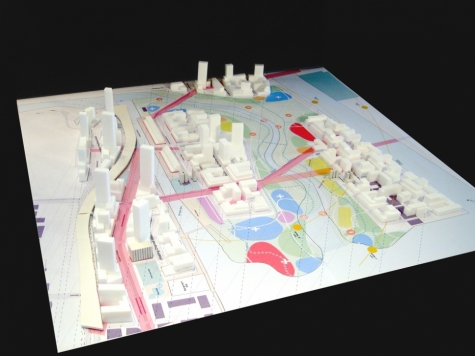
The Lower Don Lands planning effort has engaged several planning processes in parallel as well as enacted a considerable effort in the coordination with concurrent plans adjacent to the study area. The combined efforts for flood protection and naturalization of the Don River along with the creation of a vital new mixed-use urban setting well served by transit and significant new parkland shown in this Framework Plan will enable the revitalization of the Lower Don Lands to better implement and achieve the established principles of the Central Waterfront Secondary Plan.
This is a substantial and dramatic initiative for city building in Toronto, adding environmental, social, and economic value to the area and the surrounding City.


